
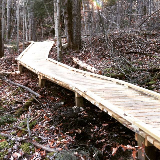
New 4k Trail: Massanutten Western Slope
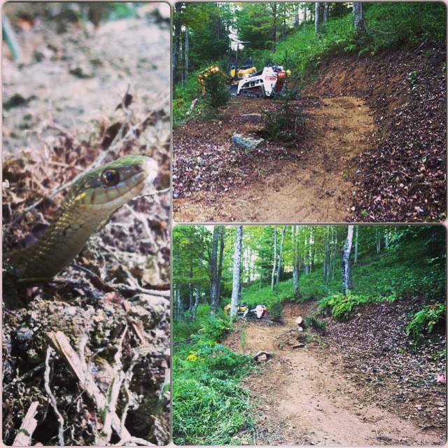
Currently, I am at the Massanutten Western Slope roughing in a new trail off of the 2k Hours Trail. This project is being hosted by the Shenandoah Valley Bicycle Coalition, being funded completely from the trail passes sold, and is the first step in further developments to link the Western Slope to the new BIKE PARK on the Resort side. You can find out more at this website: http://svbcoalition.org/every-thursday-massanutten-trail-work-4000-hour-trail/
Help the club with the finish work every thursday at 5pm!
Trail Reconstruction in Thomas City Park
The Month of April also saw several miles of trail in the Thomas City Park reconstructed, with corridor brushing, new drainage structures, and benched trails getting a refresher to remove slough and restore outslope.


Thomas City Park Trails: Pavillion Connection

Thanks to New Historic Thomas, I was able to continue accessible trail improvements in the Thomas City Park this Spring. The goal of this project was to provide a lower grade access from the upper parking lot to the pavillion at the bottom of the park. The corridor of the existing trail was utilized and expanded on with two new switchbacks to achieve an easier gradient. Like the Riverside Trail project last fall, this trail was topped off with a compacted aggregate surface.


Connecting Trails: Blackwater View Project

One of the most interesting and rewarding parts of working with Heart of the Highlands Trail the last three years has been making connections. When it comes to work on the ground (my role), so much effort has already been made and so much work has been invested that the sweat and dirt is the easy part.
Many partners become a link in a chain that only grows stronger as the process unfolds. It starts with an idea that gathers feedback. That transitions into a plan being developed. That plan requires in depth participation from land managers, planners, and regulatory oversight. Public feedback is gathered, and details start taking form. A detailed flagline is placed, materials gathered, and a work force assembled. Then a trail is finally shaped from the earth. It’s a dynamic and evolving process. That makes each connection with land managers, board members, staff, volunteers, trail users, and the public part of the succes.
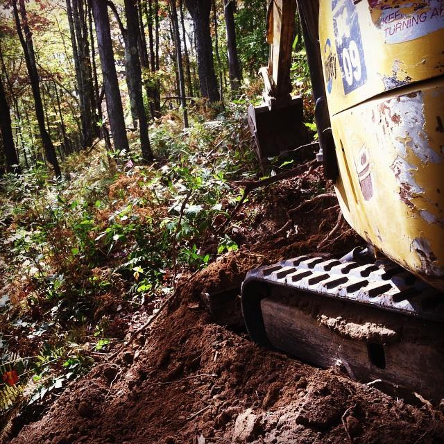
One particular project we took on this year (one of more than a few), struck a major chord for me because it makes a major multi-use (yes bikes are important to me) connection from one side of the Blackwater River to the other in the interior of Canaan Valley. A complex project with multiple phases. That means two isolated trail systems will now be connected with sustainable trail. The Blackwater View Trail project we undertook this year has many components to achieve connectivity: use change designation, sustainable upgrades on existing trail, environmental assessments, recreational easements on private property, major bridge construction, and new trail construction.
This year, we were able to follow through with planning and implement use designation and sustainable upgrades on existing trail as well as the first phase in new trail construction. We completed the first half of the new construction component during the fall, with 539′ of road to trail conversion, 958′ of new trail construction, and 224′ of rolling elevated boardwalk getting us closer to making this connection. A similar amount of road to trail conversion and new construction remains to be finished this coming year, as well as placing a major pedestrian bridge across the Blackwater River.
You can contribute, get involved, and follow along with the process by following Heart of the Highlands Trail on the web, receiving the newsletter, and liking their facebook page.


Planning Ahead: Olson Tower Area Development
In October and November, I had the opportunity to write up a development plan to help direct some specific sustainable work on the trails around the Olson Tower Area. This work was hosted by the Friends of the Blackwater and funded by the National Forest Foundation grant. That grant will also be providing funding for work on those trails and on the sectinos of the Rail Trail from Douglass to Thomas. Coordination between the Friends of the Blackwater, the USFS, the Allegheny Trail Club, and other local agencies is making this part of the project possible. Volunteer hours is a large part of this grant, so if you are interested in learning more about volunteering or about the plan in place, contact the Friends of the Blackwater at info@saveblackwater.com.
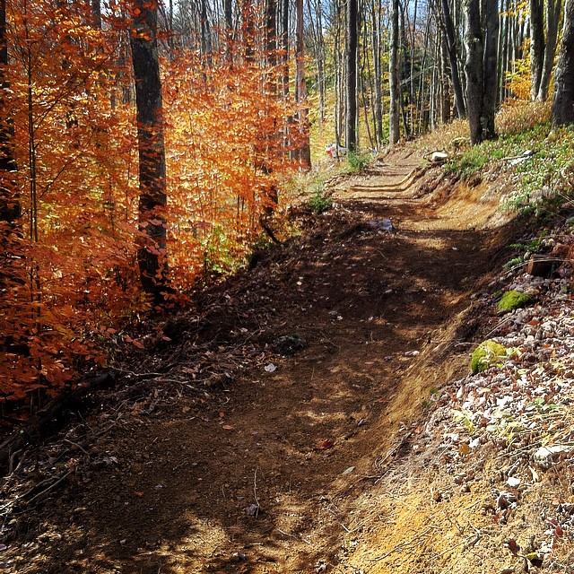
Construction Wrap up in Thomas
I’m a little late to the party with an update on construction. Building activities were wrapped up in early September, and the rest of the foot bridge work was completed in October. Hopefully you are one of the many folks that have been able to get out and enjoy the completed trail!
This trail, as noted during the last update is part of the Thomas Riverfront Development Plan. Stay updated and get involved with New Historic Thomas to see that plan realized. Next up is to complete Phase I of the plan.


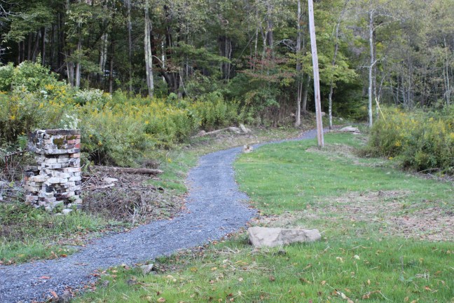
New Construction in Thomas, WV
We have started construction on a new section of trail for New Historic Thomas as part of phase 1 in the Thomas Riverfront Development Plan for the City of Thomas, WV. Trail users have caution. I know this is a popular location, partially on an existing alignment, for dog walking, running, and biking. We will be mid construction from July 25 through August 20. For information about the Riverfront Development plan or about New Historic Thomas, use the following links:
http://www.newhistoricthomas.com/
http://www.newhistoricthomas.com/s/Riverfront-Plan.jpg
Now the cool part. Construction. I am very grateful for the opportunity to build this trail. This is partially on a route locals use already to access the gem of a trail system at the Thomas City Park. The development plan calls for this trail to be as accessible as possible for folks with a handicap. While friends like Eric Thompson are quite mobile and still doing some pretty rad adventures, “ADA” or “Accessible” trails is an extremly broad term. I’d rather say how accessible this trail is and let the user decide. It is a standard 48″ wide tread with an average running grade of 5% with no more than 6.8%. I’ll give a full report at the end, but that tells you a lot about it. It will have curves for days, and some really cool positive control points like a couple heritage trees with greater than 40″ diameter. Here’s a couple pictures of current construction to get you going:
